 |
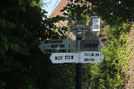
Id: 1707, Quality: 5Group: PublishedRouteLocation: BA3 5LSPostcode: BA3 5LSMap Reference: 51.0064, -2.19841Ride length: 12 kmRide ease: EasyAdded by: Neil Wheadon | |
 |
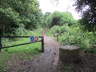
Id: 1698, Quality: 5Group: PublishedRouteLocation: GillinghamPostcode: SP8 4ATMap Reference: 51.0381, -2.27802Ride length: 24 kmRide ease: AverageAdded by: Neil Wheadon | This is the first part of the seemingly forgotten North Dorset Cycleway. Signs are still at most junctions, but there is nothing on the web, aside a pretty poor map on the Dorset County Council website. You start at Gillingham where there is a station, but for ease, I have used the closest car park ... |
 |
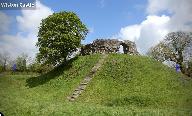
Id: 1258, Quality: 5Group: PublishedRouteLocation: Market HarboroughPostcode: LE16 7DTMap Reference: 52.4788, -0.91012Ride length: 27 kmRide ease: EasyAdded by: Neil Wheadon | See https://www.sustrans.org.uk/find-a-route-on-the-national-cycle-network/brampton-valley-way/ Start at Market Harborough Station, St Mary's Rd, Market Harborough LE16 7DT SURFACE:- The Brampton Valley Way spans over 14 miles between Northampton and Market Harborough, what was once a disused railwa ... |
 |
Id: 1122, Quality: 5Group: PublishedRouteLocation: HaverfordwestPostcode: SA61 1TPMap Reference: 51.8016, -4.96537Ride length: 42 kmRide ease: HardAdded by: Neil Wheadon | See https://www.pembrokeshire.gov.uk/cycle-pembrokeshire/cycle-pembrokeshire-wizo-trail Trave/map icon at https://tandem-club.org.uk/rides?cmd=placeView&id=10303 This was manually written up using RidewithGPS (with care) as no GPX was available. The Trail meanders through part of the central area of ... |
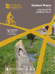 |
Id: 715, Quality: 5Group: PublishedRouteLocation: GlastonburyPostcode: BA8 8LZMap Reference: 51.1406, -2.7074Ride length: 23 kmRide ease: EasyAdded by: Neil Wheadon | see Avalon Eastern Moors Ride https://avalonmarshes.org/explore/things-to-do/cycling/ This route explores the eastern marshes including Queen's Sedge Moor, Hearty Moor, Kennard Moor and the green fringes of the Isle of Avalon. |
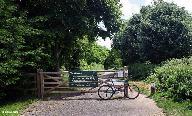 |
Id: 616, Quality: 5Group: PublishedRouteLocation: Sturminster NewtonPostcode: DT10 1BNMap Reference: 50.9269, -2.30266Ride length: 20 kmRide ease: EasyAdded by: Neil Wheadon | This is the correct way that the North Dorset trailway runs (unlike the most popular Google search that is wrong on both ends, the path does not extend north of Sturminster Newton) Details at northdorsettrailway.org.uk The North Dorset Trailway now extends approximately 14 miles from Sturminster New ... |
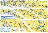 |
Id: 1899, Quality: 4Group: PublishedRouteLocation: HullPostcode: HU9 1RZMap Reference: 53.7516, -0.29714Ride length: 20 kmRide ease: EasyAdded by: Neil Wheadon | Start at Soutcoates Lane, Hull HU9 1RZ See https://www.eastridingcoastandcountryside.co.uk/places-to-visit/find-a-place/place/?entry=hull_winestead_rail_trail This off road path and bridleway begins in Hull just north of HM Prison (start off Estcourt Street, west of the playing field following the p ... |
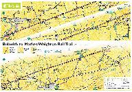 |
Id: 1898, Quality: 4Group: PublishedRouteLocation: BubwithPostcode: YO8 6DQMap Reference: 53.8112, -0.92586Ride length: 14 kmRide ease: EasyAdded by: Neil Wheadon | Start at See https://www.eastridingcoastandcountryside.co.uk/places-to-visit/find-a-place/place/?entry=marketweighton_bubwith_rail_trail This is the former Selby Driffield Railway Line. From Market Weighton you can take the Hudson Way Rail Trail to Beverley. An eight-mile off road path and bridleway ... |
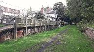 |
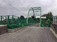
Id: 1896, Quality: 4Group: PublishedRouteLocation: Market WeightonPostcode: YO43 3HJMap Reference: 53.8666, -0.66667Ride length: 17 kmRide ease: EasyAdded by: Neil Wheadon | Start at See https://www.eastridingcoastandcountryside.co.uk/places-to-visit/find-a-place/place/?entry=hudson_way_rail_trail FEEDBACK - Much of the original cinder remains on the track bed, it's notorious for kicking up black dust and on a hot summers days when your legs are sweating, from the shins ... |
 |
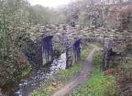
Id: 1879, Quality: 4Group: PublishedRouteLocation: BD12 7EDPostcode: OakenshawMap Reference: 53.7526, -1.74781Ride length: 31 kmRide ease: EasyAdded by: Neil Wheadon | Start at Unit 8 Kingsmark Fwy, Oakenshaw, Bradford BD12 7HW (exact start, see picture) See https://www.walkwheelcycletrust.org.uk/find-a-route-on-the-national-cycle-network/spen-valley-greenway/ See https://tandem-club.org.uk/rides?cmd=placeView&id=9058 The Spen Valley Greenway is a green corridor w ... |
 |
Id: 1877, Quality: 4Group: PublishedRouteLocation: HayfieldPostcode: SK22 2ESMap Reference: 53.3792, -1.9485Ride length: 4 kmRide ease: EasyAdded by: Neil Wheadon | The Hayfield Railway Line was opened in 1868. It carried coal, raw materials and workers to the mills and finished goods away. Summer Sundays were very busy and, in the 1920's, there could be 5,000 people getting off at Hayfield to walk in the hills. The line closed in 1970. Like many former railway ... |
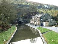 |
Id: 1870, Quality: 4Group: PublishedRouteLocation: BA3 5LSPostcode: BA3 5LSMap Reference: 53.604, -1.94116Ride length: 13 kmRide ease: EasyAdded by: Neil Wheadon | Start at Standedge Tunnel, Waters Rd, Huddersfield HD7 6NQ Approx. 8 miles. Towpath good surface throughout. Towpath is now tarmac.There is a section in Huddersfield where you have to leave the towpath where the canal is under buildings. Ride can be extended on the Huddersfield Broad Canal and then ... |
 |
Id: 1868, Quality: 4Group: PublishedRouteLocation: DedhamPostcode: CO7 6DHMap Reference: 51.959, 0.99356Ride length: 21 kmAdded by: Neil Wheadon | Start at Mill Ln, Dedham, Colchester CO7 6DH See https://dedhamvale-nl.org.uk/wp-content/uploads/2020/12/7-Dedham-Walk.pdf See https://dedhamvale-nl.org.uk/visiting/visitor-guides/cycle-guides/ A delightful route that gives you a real sense of being in Constable Country. This easy going route incorp ... |
 |
Id: 1867, Quality: 4Group: PublishedRouteLocation: Stoke by NaylandPostcode: CO6 4SEMap Reference: 51.9895, 0.8946Ride length: 23 kmRide ease: AverageAdded by: Neil Wheadon | Start at Stoke by Nayland CO6 4SE See https://dedhamvale-nl.org.uk/wp-content/uploads/2020/12/6-Stoke-by-Nayland-Walk.pdf See https://dedhamvale-nl.org.uk/visiting/visitor-guides/cycle-guides/ An attractive route that takes in some quaint villages and hamlets. There are a number of hills that are mo ... |
 |
Id: 1866, Quality: 4Group: PublishedRouteLocation: BuresPostcode: CO8 5AEMap Reference: 51.9715, 0.76854Ride length: 30 kmAdded by: Neil Wheadon | Start at Bures CO8 5AE See https://dedhamvale-nl.org.uk/wp-content/uploads/2020/12/5-Bures-and-Nayland-Walk.pdf See https://dedhamvale-nl.org.uk/visiting/visitor-guides/cycle-guides/ This is a charming route past a lot of history that takes you along the lower part of the river valley with easy to m ... |
 |
Id: 1865, Quality: 4Group: PublishedRouteLocation: BuresPostcode: CO8 5DHMap Reference: 51.9715, 0.76854Ride length: 30 kmRide ease: AverageAdded by: Neil Wheadon | Start at Bures Railway Station, Bures CO8 5DH See https://dedhamvale-nl.org.uk/wp-content/uploads/2020/12/4-Bures-and-Sudbury-Walk.pdf See https://dedhamvale-nl.org.uk/visiting/visitor-guides/cycle-guides/ A scenic route along the river Stour with the touring route passing through Sudbury. There are ... |
 |
Id: 1864, Quality: 4Group: PublishedRouteLocation: Melford, SudburyPostcode: CO10 9HHMap Reference: 52.0606, 0.70808Ride length: 20 kmRide ease: AverageAdded by: Neil Wheadon | Start at Melford Country Park, 7 Borley Rd, Long Melford, Sudbury CO10 9HH See https://dedhamvale-nl.org.uk/wp-content/uploads/2020/12/3-Long-Melford-Walk.pdf See https://dedhamvale-nl.org.uk/visiting/visitor-guides/cycle-guides/ This is a lovely route that takes in some beautiful villages in North ... |
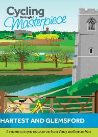 |
Id: 1863, Quality: 4Group: PublishedRouteLocation: IP29 4DHPostcode: Hartest, Bury Saint EdmundsMap Reference: 52.1403, 0.6779Ride length: 15 kmRide ease: AverageAdded by: Neil Wheadon | Start at Hartest Village Green, Hartest, Bury Saint Edmunds IP29 4DH See https://dedhamvale-nl.org.uk/wp-content/uploads/2020/12/2-Hartest-and-Glemsford-Walk.pdf See https://dedhamvale-nl.org.uk/visiting/visitor-guides/cycle-guides/ This is a rural route which takes you through villages in High Suff ... |
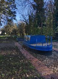 |
Id: 1845, Quality: 4Group: PublishedRouteLocation: ChippenhamPostcode: SN15 1ESMap Reference: 51.4612, -2.11863Ride length: 11 kmRide ease: EasyAdded by: Neil Wheadon | See https://www.chippenham.gov.uk/parks-and-outdoor-spaces/river-route-cycleway/ SURFACE - 2021 - Most of the surface is "dirt" and quite decent but there is a section just after that bridge which is distinctly "mud" even in summer and needs improving. SURFACE 2025 - There isn't really any new tarma ... |
 |
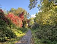
Id: 1836, Quality: 4Group: PublishedRouteLocation: ReethPostcode: DL11 6SPMap Reference: 54.3885, -1.94113Ride length: 21 kmRide ease: HardAdded by: Neil Wheadon | See https://www.yorkshiredales.org.uk/wp-content/uploads/sites/13/2019/08/YDNPA-The-Swale-Trail-leaflet_FINAL.pdf See https://cyclethedales.org.uk/wp-content/uploads/sites/10/2023/11/SWALE_TRAIL_PDF.pdf See https://cyclethedales.org.uk/route/swale_trail/ Youtube video of a Tandem Riding it at https: ... |
 |
Id: 1763, Quality: 4Group: PublishedRouteLocation: DerbyPostcode: DE1 2EPMap Reference: 52.9237, -1.47404Ride length: 21 kmRide ease: EasyAdded by: Neil Wheadon | Start at Derwent Street (Exeter Bridge) Derby Derbyshire DE1 2EP Mostly tarmac, the first 3 miles are compacted gravel See https://www.sustrans.org.uk/find-a-route-on-the-national-cycle-network/derby-canal-path-and-the-cloud-trail/ See https://www.visitsouthderbyshire.co.uk/route/derby/the-cloud-tra ... |
 |
Id: 1697, Quality: 4Group: PublishedRouteLocation: Woodhall SpaPostcode: LN10 6URMap Reference: 53.1657, -0.18121Ride length: 5 kmRide ease: EasyAdded by: Neil Wheadon | Start at Sandy Ln, Woodhall Spa LN10 6UR See https://www.woodhallspa.org/wp/?page_id=304 See https://www.horncastlewalkers.co.uk/wp-content/uploads/2017/04/spa_trail.pdf Can be linked in with https://tandem-club.org.uk/rides?cmd=view&id=1278 This is a linear route of approximately 2.9 km (1.8 miles) ... |
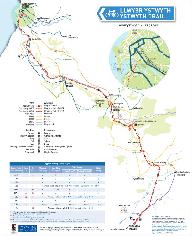 |
Id: 1663, Quality: 4Group: PublishedRouteLocation: AberystwythPostcode: SY23 1PLMap Reference: 52.4113, -4.08294Ride length: 30 kmRide ease: EasyAdded by: Neil Wheadon | Start at Maesyrafon Car Park, Aberystwyth SY23 1PL See https://www.pumlumon.org.uk/wp-content/uploads/2021/08/ystwyth_trail-start_finish1.pdf See https://www.discoverceredigion.wales/outdoor-activities-and-adventures/walk-ceredigion/ystwyth-trail/ and https://www.discoverceredigion.wales/media/2020/ ... |
 |
Id: 1593, Quality: 4Group: PublishedRouteLocation: AudenshawPostcode: M34 5QAMap Reference: 53.4714, -2.14589Ride length: 10 kmRide ease: EasyAdded by: Neil Wheadon | Start at Fairfield Station, Audenshaw, Manchester M34 5QA See https://fallowfieldloop.org/ The Fallowfield Loop is an off-road cycle path, pedestrian and horse riding route from Chorlton-cum-Hardy through Fallowfield and Levenshulme to Gorton and Fairfield in Manchester. It is part of the National C ... |
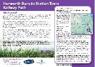 |
Id: 1590, Quality: 4Group: PublishedRouteLocation: WingatePostcode: TS28 5NNMap Reference: 54.6924, -1.36625Ride length: 3 kmRide ease: EasyAdded by: Neil Wheadon | Start at Hurwith Burn, Wingate TS28 5NN See https://www.durham.gov.uk/media/4403/Railway-Path-Hurworth-Burn-Station-Town/pdf/RailwayPathHurworthBurnStationTown.pdf?m=1537967456613 This former railway line opened in 1877, with its station opening three years later. The goods trains running along this ... |
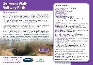 |
Id: 1589, Quality: 4Group: PublishedRouteLocation: ConsettPostcode: DH8 7NUMap Reference: 54.8396, -1.84655Ride length: 19 kmRide ease: EasyAdded by: Neil Wheadon | Start at Lydgetts Junction car park, Consett DH8 7NU See https://www.durham.gov.uk/media/4402/Railway-Path-Derwent-Walk/pdf/RailwayPathDerwentWalk.pdf?m=1537967454663 The Derwent Walk is an extremely popular linear route between Consett and Swalwell, with fabulous views across the Derwent Valley. It ... |
 |
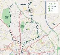
Id: 1588, Quality: 4Group: PublishedRouteLocation: BroomparkPostcode: DH7 7RJMap Reference: 54.7645, -1.61044Ride length: 15 kmRide ease: EasyAdded by: Neil Wheadon | Start at Broompark picnic area , Broompark, Durham DH7 7RJ See https://www.durham.gov.uk/media/4401/Railway-Path-Brandon-Bishop/pdf/RailwayPathBrandonBishop.pdf?m=1537967454223 The line was built mainly to carry coal and coke and closed to passenger traffic in 1964. It is now a route enjoyed by both ... |
 |
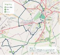
Id: 1587, Quality: 4Group: PublishedRouteLocation: ChesterPostcode: CH2 2AUMap Reference: 53.196, -2.89191Ride length: 14 kmRide ease: EasyAdded by: Neil Wheadon | Start at Brio Leisure Northgate Arena, Victoria Rd, Chester CH2 2AU See https://chestercyclecity.org/the-zoo-circular/ The Chester Zoo Circular is a short, circular route of 13 kms (8 miles). It follows the canal towpath for the outward journey to Chester Zoo, and then follows NCN Route 56 and NCN R ... |
 |
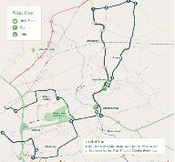
Id: 1586, Quality: 4Group: PublishedRouteLocation: ChesterPostcode: CH1 4EZMap Reference: 53.194, -2.89904Ride length: 27 kmRide ease: EasyAdded by: Neil Wheadon | Start at Chester CH1 4EZ See https://chestercyclecity.org/the-dodleston-doddle/ The Dodleston Doddle explores a mixture of countryside and more urban areas to the south-west of Chester, including Dodleston, Gorstella, Lower Kinnerton and Westminster Park. The route is 26 km (16 miles) in length with ... |
 |
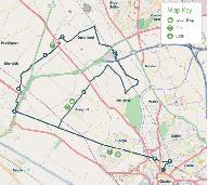
Id: 1585, Quality: 4Group: PublishedRouteLocation: ChristletonPostcode: CH3 7AWMap Reference: 53.1876, -2.83592Ride length: 27 kmRide ease: EasyAdded by: Neil Wheadon | Start at Christleton Methodist Church, 20 The Square, Christleton, Chester CH3 7AW See https://chestercyclecity.org/the-manley-meander/ The Manley Meander explores the countryside to the east of Chester, taking in places of interest such as Christleton Pond and the Manley Windsurfing Centre. The rou ... |
 |
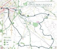
Id: 1584, Quality: 4Group: PublishedRouteLocation: ChesterPostcode: CH2 2AUMap Reference: 53.196, -2.89197Ride length: 33 kmRide ease: EasyAdded by: Neil Wheadon | Start at Brio Leisure Northgate Arena, Victoria Rd, Chester CH2 2AU See https://chestercyclecity.org/wp-content/uploads/2016/12/Family%20Route%205%20-%20Capenhurst%20Caper.pdf The Capenhurst Caper is a 26 km (18 mile) route, exploring the countryside to the north of Chester. It makes use of National ... |
 |
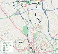
Id: 1583, Quality: 4Group: PublishedRouteLocation: ChesterPostcode: CH1 3LHMap Reference: 53.1934, -2.88808Ride length: 34 kmAdded by: Neil Wheadon | Start at The Lock Keeper, 1 Canal Side, Cheshire, Chester CH1 3LH The Hockenhull Hobble explores the countryside to the SE of Chester, including Christleton Pond, Bruera and Hargarave villages, and Hockenhull Platts. The route is 33 km (20 miles) long. There is a short off-road section over the inte ... |
 |
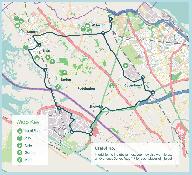
Id: 1582, Quality: 4Group: PublishedRouteLocation: ChesterPostcode: CH1 2DYMap Reference: 53.1918, -2.89214Ride length: 26 kmAdded by: Neil Wheadon | Start at Chester Cathedral, St Werburgh St, Chester CH1 2DY See https://chestercyclecity.org/wp-content/uploads/2016/12/Family%20Route%206%20-%20Backford%20Beat.pdf The Backford Beat explores the countryside to the north of Chester. It follows the canal towpath north to Caughall, and takes in Stanne ... |
 |
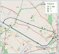
Id: 1581, Quality: 4Group: PublishedRouteLocation: Ellesmere PortPostcode: CH66 7NLMap Reference: 53.2979, -2.97601Ride length: 34 kmAdded by: Neil Wheadon | Start at Hooton Station, Ellesmere Port CH66 7NL Spectacular views across the Dee Estuary to Wales is a feature of this route as it crosses the Burton Marshes on a purpose built boardwalk. You have the option of cycling to join the route from Chester via the Millennium Greenway - or you can catch a ... |
 |
Id: 1580, Quality: 4Group: PublishedRouteLocation: ChesterPostcode: CH1 4EZMap Reference: 53.1934, -2.89941Ride length: 21 kmRide ease: EasyAdded by: Neil Wheadon | Start at Telfords Warehouse, Tower Wharf, Raymond St, Chester CH1 4EZ I have traced the route to produce the GPX. The very last part ' 8 After another 2 kms, the cycle path enters The Cop park. Cross Sealand Road into Southview Rd, up the slope. Go through the white gate to the main canal. Follow th ... |
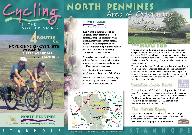 |
Id: 1579, Quality: 4Group: PublishedRouteLocation: StanhopePostcode: DL13 2FJMap Reference: 54.7482, -2.00766Ride length: 40 kmRide ease: HardAdded by: Neil Wheadon | Start at The Durham Dales Centre, 1C Castle Gardens, Stanhope, Bishop Auckland DL13 2FJ See https://northpennines.org.uk/visit-explore/cycling/ See https://northpennines.org.uk/wp-content/uploads/2019/11/Cycling-in-the-North-Pennines-Stanhope.pdf The four routes are designed as a series of loops and ... |
 |
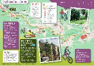
Id: 1571, Quality: 4Group: PublishedRouteLocation: AlstonPostcode: CA10 1RNMap Reference: 54.7109, -2.38512Ride length: 43 kmRide ease: EasyAdded by: Neil Wheadon | Start at Alston CA10 1RN The GPX was hand drawn remotely and shoud be correct. The location with postcode is approximate though. Great PDF leaflet See https://northpennines.org.uk/location/south-tyne-trail/ See https://northpennines.org.uk/wp-content/uploads/2020/01/South-Tyne-Trail.pdf The South Ty ... |
 |
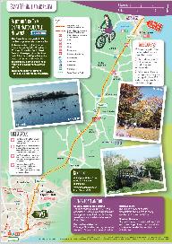
Id: 1569, Quality: 4Group: PublishedRouteLocation: Hebden BridgePostcode: HX7 6JEMap Reference: 53.7377, -2.00839Ride length: 19 kmRide ease: EasyAdded by: Neil Wheadon | Start at Hebden Bridge Station, Station Rd, Hebden Bridge HX7 6JE The GPX was created from the description and the map as many are. This one was quite hard remotely but is just about correct See https://www.sustrans.org.uk/our-blog/national-cycle-network-route-collections/slow-tour-of-yorkshire/ See ... |
 |
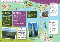
Id: 1568, Quality: 4Group: PublishedRouteLocation: HullPostcode: HU1 3QXMap Reference: 53.7445, -0.34488Ride length: 24 kmRide ease: EasyAdded by: Neil Wheadon | Start at Hull Station, Paragon Station, Ferensway, Hull HU1 3QX Part of the Trans Penine Trail See https://www.sustrans.org.uk/our-blog/national-cycle-network-route-collections/slow-tour-of-yorkshire/ See https://www.sustrans.org.uk/media/5100/stoy_19.pdf This wonderful, mainly traffic free route ta ... |
 |
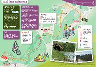
Id: 1567, Quality: 4Group: PublishedRouteLocation: Barton-upon-HumberPostcode: DN18 5QEMap Reference: 53.6889, -0.44375Ride length: 9 kmRide ease: EasyAdded by: Neil Wheadon | Start at Barton-upon-Humber train station, Barton-upon-Humber DN18 5QE See https://www.sustrans.org.uk/our-blog/national-cycle-network-route-collections/slow-tour-of-yorkshire/ See https://www.sustrans.org.uk/media/5101/stoy_18.pdf This unique ride is mainly traffic-free and gives you the chance to ... |
 |
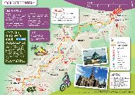
Id: 1566, Quality: 4Group: PublishedRouteLocation: DoncasterPostcode: DN1 1PEMap Reference: 53.5224, -1.13821Ride length: 12 kmRide ease: EasyAdded by: Neil Wheadon | Start at Doncaster Station, Station Court, Doncaster DN1 1PE See https://www.sustrans.org.uk/our-blog/national-cycle-network-route-collections/slow-tour-of-yorkshire/ This lovely traffic-free route follows the River Don, taking you from the bustling town of Doncaster to 12th century Conisbrough Cast ... |
 |
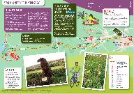
Id: 1565, Quality: 4Group: PublishedRouteLocation: SheffieldPostcode: S1 2BPMap Reference: 53.3878, -1.46055Ride length: 18 kmAdded by: Neil Wheadon | Start at Sheffield Station, Sheaf St, Sheffield City Centre, Sheffield S1 2BP This is part of the Trans Penine Trail See https://www.sustrans.org.uk/media/5103/stoy_16.pdf See https://hedgehogcycling.co.uk/sheffield-rotherham-bike-ride.html Most of these slow rides are described here. The plotaroute ... |
 |
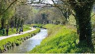
Id: 1564, Quality: 4Group: PublishedRouteLocation: PenistonePostcode: S36 6HPMap Reference: 53.5253, -1.62319Ride length: 10 kmRide ease: EasyAdded by: Neil Wheadon | Start at Penistone Station, Penistone, Sheffield S36 6HP See https://www.sustrans.org.uk/our-blog/national-cycle-network-route-collections/slow-tour-of-yorkshire/ This beautiful, traffic-free ride takes you from the busy market town of Penistone, into the rolling moors of the Peak District to the re ... |
 |
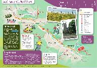
Id: 1563, Quality: 4Group: PublishedRouteLocation: Saint AustellPostcode: PL25 4SZMap Reference: 50.3378, -4.79014Ride length: 12 kmRide ease: EasyAdded by: Neil Wheadon | Start at 22-20 East Hill, Saint Austell PL25 4SZ See https://www.visitcornwall.com/things-to-do/walking/pentewan-valley-trail See https://www.staustell.co.uk/discover/pentewan-valley-trail/ See https://www.sustrans.org.uk/find-a-route-on-the-national-cycle-network/pentewan-trail/ The trail follows t ... |
 |
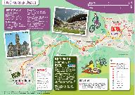
Id: 1562, Quality: 4Group: PublishedRouteLocation: BarnsleyPostcode: S71 1PBMap Reference: 53.5541, -1.4769Ride length: 9 kmRide ease: EasyAdded by: Neil Wheadon | Start at Barnsley Railway Station, Barnabas Walk, Barnsley S71 1PB See https://www.sustrans.org.uk/media/5105/stoy_14.pdf This great route takes you from the bustling town of Barnsley to Old Moor RSPB Reserve which is teeming with birds and wildlife. |
 |
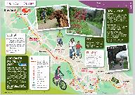
Id: 1561, Quality: 4Group: PublishedRouteLocation: HuddersfieldPostcode: HD1 1JBMap Reference: 53.6502, -1.78395Ride length: 15 kmRide ease: EasyAdded by: Neil Wheadon | Start at Huddersfield Railway Station, St George's Square, Huddersfield HD1 1JB See https://www.sustrans.org.uk/media/5106/stoy_13.pdf This route takes you from Huddersfield, with its beautiful mix of Georgian, Victorian and neo-classical architecture, and birthplace of Rugby League, to the minster ... |
 |
Id: 1560, Quality: 4Group: PublishedRouteLocation: OssettPostcode: WF5 8BEMap Reference: 53.6802, -1.5797Ride length: 19 kmRide ease: EasyAdded by: Neil Wheadon | Start at Ossett Town Hall, Town Hall, Market Place, Ossett WF5 8BE See https://www.sustrans.org.uk/media/5107/stoy_12.pdf This great ride begins at Ossett Town Hall and travels to Dewsbury, before heading north through the Spen Valley to the southern edge of Bradford using the traffic- free Spen Val ... |
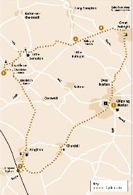 |
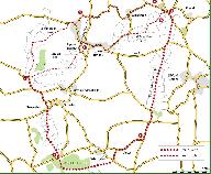
Id: 1548, Quality: 4Group: PublishedRouteLocation: KinghamPostcode: OX7 6UPMap Reference: 51.9016, -1.6283Ride length: 30 kmAdded by: Neil Wheadon | Start at Kingham Station, Station Rd, Kingham, Chipping Norton OX7 6UP See https://www.cotswolds-nl.org.uk/exploring/cycle-route/ancient-stones-old-manors/ Cycle routes from Kingham Station Cycle Route 5: Ancient Stones & Old Manors A chance to visit both Chastleton House, the Rollright Stones and d ... |
 |
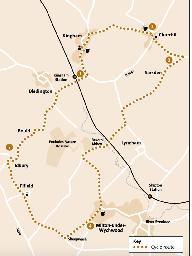
Id: 1547, Quality: 4Group: PublishedRouteLocation: BA3 5LSPostcode: BA3 5LSMap Reference: 52.0139, -1.51613Ride length: 24 kmRide ease: HardAdded by: Neil Wheadon | Start at See https://www.cotswolds-nl.org.uk/exploring/cycle-route/brailes-hill-and-ascot/ This is a ride of tracks and vistas. It takes you around the Vale of Feldon by riding over the Ironstone Hills and around Brailes Hill. The views are great and the tracks are good though largely soft and un-su ... |
 |
Id: 1546, Quality: 4Group: PublishedRouteLocation: KinghamPostcode: OX7 6UPMap Reference: 51.9016, -1.62813Ride length: 22 kmAdded by: Neil Wheadon | Start at Kingham Station, Station Rd, Kingham, Chipping Norton OX7 6UP See https://www.cotswolds-nl.org.uk/exploring/cycle-route/bruern-to-foxholes-nature-reserve/ A delightful short tour through Cotswold border villages, passing the site of an ancient abbey and visiting a beautiful secluded Wildlif ... |


