
Account
Pictures
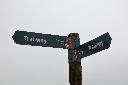
Trailway Signpost
Tandem Club GPX/TCX Rides list
 |
Id: 1570, Quality: 5 Group: WestCountry Location: Melksham Postcode: SN12 8AG Map Reference: 51.3848, -2.14359 Ride length: 66 km Ride ease: Average Added by: Neil Wheadon | Start - Leekes car park Beanacre Rd, Melksham SN12 8AG , free parking This is a fabulous ride, if you are in Melksham, thoroughly recommended This ride is an imaginative tip utilising quieter roads, cycleways and byways in the Western part of Wiltshire. Starting at the car par in Leeks, you will he ... |
 |
Id: 428, Quality: 5 Group: WestCountry Location: Chipping Sodbury Postcode: BS37 6AD Map Reference: 51.5382, -2.39483 Ride length: 37 km Ride ease: Average Added by: Terry Barnaby | This ride is perfect for a winter day and the West Country group did this in November 2021...enjoy Starting in the pretty Market town of Chipping Sobury, the ride heads north crossing Horton Common with extensive views. You will pick up the Avon Cycleway as the route heads west to Rangeworthy and th ... |
 |
Id: 344, Quality: 5 Group: WestCountry Location: Radstock Postcode: BA3 3GB Map Reference: 51.2916, -2.44884 Ride length: 19 km Ride ease: Average Added by: Neil Wheadon | From Radstock to Bath, via the Two Tunnels along Route 24 |
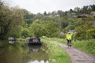 |
Id: 318, Quality: 5 Group: WestCountry Location: Bath Postcode: BA1 3JN Map Reference: 51.3853, -2.40019 Ride length: 69 km Ride ease: Average Added by: Neil Wheadon | Starting at the end of the Bath Bristol Cycletrack this ride takes you out of Bath along route 24 through the Two Tunnels towards Wellow. Doubling back you'll head through Monkton Coombe to access the towpath of the Kennet and Avon Canal to ride along the wide path to Bradford-on-Avon (The 2 tunnels ... |
 |
Id: 298, Quality: 5 Group: WestCountry Location: Mells Postcode: BA11 3PF Map Reference: 51.2397, -2.38789 Ride length: 36 km Ride ease: Average Added by: Neil Wheadon | This very diverse route starts in the pretty village of Mells. It heads through Great Elm and into Frome. There are a few climbs in this section (until the railway path is completed in a few years) Through the outskirts of Frome to exit on a purpose built path. Care as you cross a fast road and into ... |
 |
Id: 1860, Quality: 4 Group: WestCountry Location: BA5 1FD Postcode: Cathedral Ave, Wells Map Reference: 51.2019, -2.64889 Ride length: 47 km Ride ease: Average Added by: Neil Wheadon | Starting at Wells Vets (What3words fantastic.operating.thanks) ) the ride head along Eurovelo 4 along the old railway line. The Somerset ring AKA The Strawberry Line is being built so we will take several very new sections. The first leaves Wells heading east, after which we take to the lanes south ... |
 |
Id: 1859, Quality: 4 Group: WestCountry Map Reference: 51.3501, -2.61328 Ride length: 34 km Added by: Stuart Hibberd | Meet at 09:30 for coffee at the Salt and Malt Cafe Chew Valley Lake, Wally Lane, Chew Magna. BS40 8SZ. This is a terrific ride to the south west of Bristol through pretty scenery and using quiet lanes. Starting at Chew Valley lake you head along Eurovelo 1 through Chew Magna and then through the lan ... |
 |
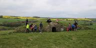
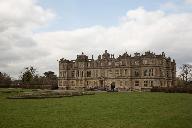
Id: 1847, Quality: 4 Group: WestCountry Location: BS9 1LH Postcode: BS9 1LH Map Reference: 51.4945, -2.66172 Ride length: 29 km Ride ease: Average Added by: Peter Weeks | Route is a round trip starting and ending at The Lamplighters pub, Shirehampton with a deviation at the start going via Kings Weston House. You can leave the deviation out and simply go from the Lamplighters to the M5 bridge to cross the River Avon. |
 |
Id: 1767, Quality: 4 Group: WestCountry Location: Lyde Green Postcode: BS16 7GG Map Reference: 51.4938, -2.46821 Ride length: 66 km Added by: Neil Wheadon | We met at Lyde Green park and ride at 09:00, an ideal time, free parking as well. Setting off there was a pavement cyclepath all the way to Pucklechurch. We cotinued east just south of the M$ with good views gradually climbing with a short steep part out of Hinton. The reward a glorious gradual down ... |
 |
Id: 1379, Quality: 4 Group: WestCountry Location: Alveston Postcode: BS35 3QU Map Reference: 51.5844, -2.52829 Ride length: 66 km Added by: Neil Wheadon | Meet at Wolfridge Alpaca Barn Alveston BS35 3QU at 09:30 for coffee ride starts at 10:15. Suggest on street parking on Greenhill (west side of A38). map Ride to the Tudor Arms at Slimbridge for lunch followed by afternoon stop at the Birdcage in Charfield. |
 |
Id: 1281, Quality: 4 Group: WestCountry Map Reference: 51.4984, -2.22324 Ride length: 54 km Added by: Neil Wheadon | Meet at 09:30 at Castle Combe Car park, Upper Castle Combe, Chippenham SN14 7HH. Car park charges now apply GBP5.20 cash only or by MiPermit. West Country Tandem Ride 25th January 2025 map Ride to Spindles in Whitley for coffee then on to Corsham for lunch. This is a wonderful and well thought out t ... |
 |
Id: 940, Quality: 4 Group: WestCountry Location: Charfield Postcode: GL12 8TG Map Reference: 51.6286, -2.40183 Ride length: 55 km Ride ease: Hard Added by: Neil Wheadon | Meet at Charfield Village Hall Wotton Rd, Charfield, Wotton-under-Edge. GL12 8TG at 09:30 - no official parking in Charfield so suggest TC members simply find somewhere in the village suitable on the day. map Cafe at Charfield open from 9am if anyone wants to grab a quick pre-ride drink. Morning cof ... |
 |
Id: 876, Quality: 4 Group: WestCountry Location: 3 Cathedral Ave, Wells Postcode: BA5 1FD Map Reference: 51.2017, -2.64857 Ride length: 54 km Added by: Neil Wheadon | Starting from the southern edge of Wells, we pick up Sustrans route 3 as it heads east. Part of the Mendip Ring, this will hopefully connect to Shepton Mallet in the coming years as it follows the former railway line. There are a number of ways to Glastonbury and this route takes the recommended cyc ... |
 |
Id: 869, Quality: 4 Group: WestCountry Location: Flax Bourton Postcode: BS48 3QT Map Reference: 51.4252, -2.68222 Ride length: 43 km Ride ease: Average Added by: Neil Wheadon | |
 |
Id: 856, Quality: 4 Group: WestCountry Location: Bristol Golf Course, St. Swithins Park, Blackhorse Hill, Almondsbury, Bristol Postcode: BS10 7TP Map Reference: 51.5318, -2.60015 Ride length: 33 km Ride ease: Average Added by: Neil Wheadon | A lovely ride that the West Country group did in December 2023 The weather was about 10 degrees so pretty good for the time of year The first half of the ride took in many cyclepaths to reach the Severn Estuary There was one longer climb towards the end |
 |
Id: 736, Quality: 4 Group: WestCountry Location: Worcester Postcode: WR8 0EE Map Reference: 52.0948, -2.27402 Ride length: 49 km Added by: Stuart Hibberd | Sunday ride. Starting from Blackmoor Camping and Caravaning Club site. 2, Hanley Swan, Worcester WR8 0EE. map |
 |
Id: 735, Quality: 4 Group: WestCountry Location: Worcester Postcode: WR8 0EE Map Reference: 52.0971, -2.27575 Ride length: 63 km Added by: Stuart Hibberd | Saturday medium ride. Starting from Blackmoor Camping and Caravaning Club site. 2, Hanley Swan, Worcester WR8 0EE. There will be a choice of two rides both heading out first to explore the cathedral city of Worcester, the shorter ride of circa 47km looping back to the camp site and with the slightly ... |
 |
Id: 640, Quality: 4 Group: WestCountry Location: Wells Postcode: BA5 1FD Map Reference: 51.2017, -2.64877 Ride length: 54 km Added by: Neil Wheadon | This ride starts at Shepton Vets, Wells branch. Parking has been especially arranged, so if you are doing this route at a later date, there is street parking reasonably close. (The vets work 6 days a week) Starting from Wells the ride starts along the former Wells to Shepton Mallet railway line whic ... |
 |
Id: 590, Quality: 4 Group: WestCountry Location: Thornbury Postcode: BS35 2AT Map Reference: 51.6072, -2.52327 Ride length: 58 km Added by: Terry Barnaby | Meet at Rock Street car park Thornbury BS35 2FH at 09:30 (Use Long Stay section) BEWARE of HEIGHT BARRIER at Car Park Entrance map Ride to the Black Shed at Slimbridge via Hideout Lounge, Tortworth for coffee. |
 |
Id: 582, Quality: 4 Group: WestCountry Location: Radstock Postcode: BA3 3AA Map Reference: 51.2933, -2.44794 Ride length: 68 km Ride ease: Average Added by: Neil Wheadon | Starting at Radstock, you set out along the Norton Radstock Greenway before taking the gentle but long climb to the western edge of Chilcompton. A lane lined by farms leads to Chewton Mendip where there is a cafe stop at Lynd's Loaf. There isn't a great deal of seating here, but she bakes. Another l ... |